Smarter geospatial data discovery starts here
Spend your time on analysis and insights that drive real impact.

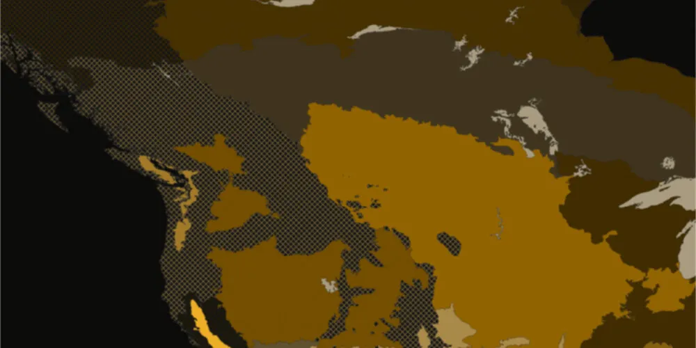
.webp)
The everyday challenge for GIS professionals
Built to end the frustration of fragmented data discovery
Every day, satellites, drones, and sensors generate massive amounts of geospatial data. That data is scattered across services and APIs, with limited tools to search and evaluate it effectively inside GIS platforms.
As a result, valuable time is spent hunting for data instead of analyzing it. Fragmented discovery slows projects, creates uncertainty, and limits the impact of GIS work.
Spatineo Discovery is built to transform how GIS work gets done. It is designed specifically for ArcGIS workflows and powered by the world’s largest continuously monitored database of geospatial services.

From query to integration in seconds
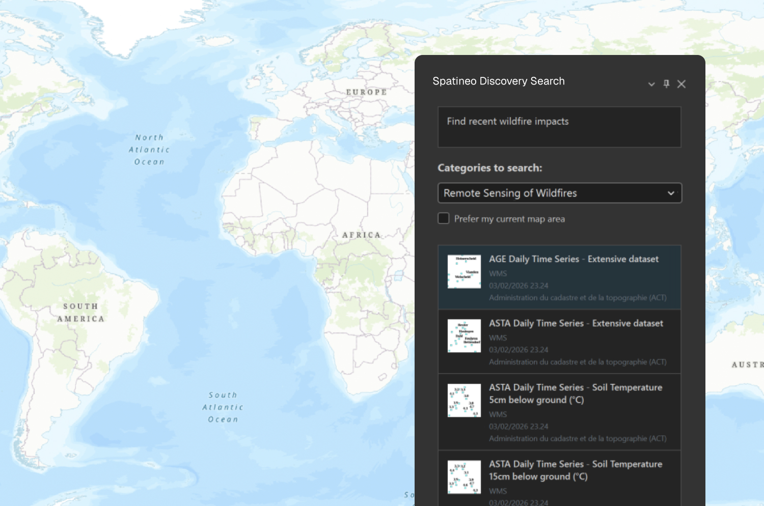
Describe your task
Tell Spatineo Discovery what you need, and our AI-powered search finds the most relevant datasets for your specific use case.
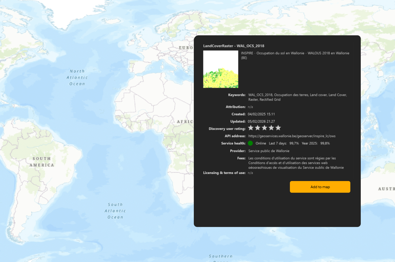
Review results and get suggestions
Spatineo Discovery understands your search intent to suggest and pick the most relevant geospatial datasets for your project.
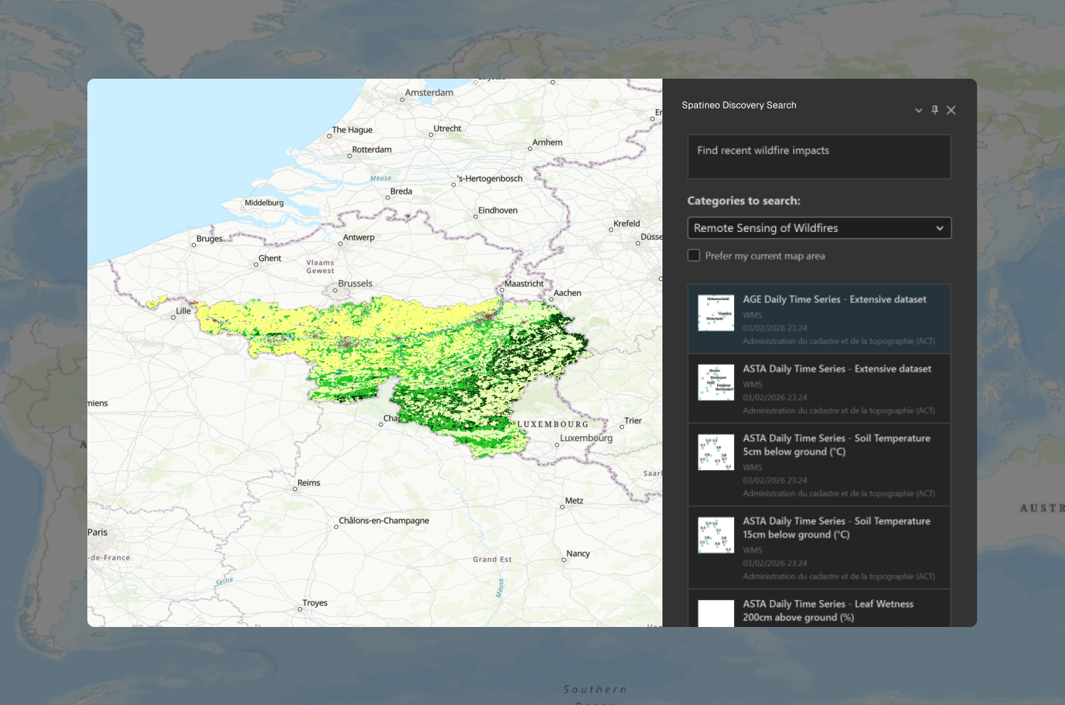
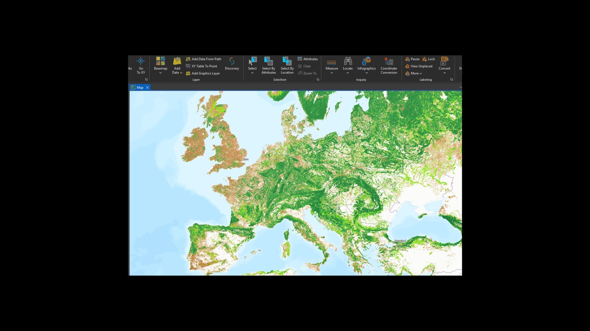
Add data directly to ArcGIS Pro
Import task-relevant data to your project with one click and start your analysis immediately.

Start discovering today
Join teams that have transformed how they work with spatial data.

What makes Spatineo Discovery® work for you

Semantic AI search
Find what you need instantly by describing your task or problem in plain language.

Multi-language support
Search using your preferred language.

ArcGIS Pro plugin
Access every dataset directly inside your familiar GIS workspace.

Service health monitoring
View performance and availability for every geospatial service.

Smart geospatial filtering
Automatically match datasets to your area of interest and filter out irrelevant results.

Discovery® industry use cases
Explore how different industries leverage Spatineo Discovery® to accelerate their data search and streamline their workflows.

Land use planning
A critical step in land use planning is gathering various data into a single map. When planning complex projects like a residential area near a city center, you need to find and overlay a vast number of datasets, such as road networks and utility infrastructure.
Spatineo Discovery removes the friction of jumping between portals, enabling planners to find and import relevant datasets directly into ArcGIS Pro for instant site evaluation. It transforms hours of searching into a rapid process that delivers immediate and actionable insights.

Forest health monitoring
Foresters depend on timely, relevant geospatial data to detect pest infestations and drought conditions before they escalate. Spatineo Discovery connects them to datasets on vegetation and land cover in seconds, enabling immediate integration into ArcGIS Pro for critical health assessments.
This streamlined access ensures that forestry professionals can base their management decisions on the most accurate information, cutting weeks off planning cycles and ensuring a timely response to forest disturbances.

Wildfire response and control
When a wildfire breaks out, emergency responders need immediate access to accurate data. Every second counts, yet responders often struggle to find up-to-date terrain info or predict fire movement because they don't know exactly which datasets exist for that specific location.
Spatineo Discovery uses smart geospatial filtering to find relevant datasets for the fire hazard areas in seconds. Even without knowing dataset names, teams can quickly discover and visualize critical info directly in ArcGIS Pro, ensuring rescue efforts are backed by the best spatial intelligence.

Built for GIS-powered organizations and professionals who need results fast
Spatineo Discovery® delivers the speed and visibility professional GIS environments require. Our product scales across industries to transform how organizations find, assess, and utilize critical spatial information.
Ready to transform your data discovery?
Join the GIS organizations using Spatineo Discovery to find relevant data faster and turn it into actionable insights.

Our latest insights and resources
Explore our latest news and use cases to see how Spatineo Discovery® is transforming geospatial workflow across industries.


Spatineo is trusted by


Our strategic ecosystem partners

Our partnership with Esri ensures seamless integration between Spatineo’s tools and the ArcGIS ecosystem. Together, we provide solutions that enhance data discoverability and streamline workflows for Esri users. esri.com

As an active member of the Open Geospatial Consortium (OGC), Spatineo contributes to the development of global geospatial standards. Through long-standing involvement in OGC working groups — including leadership roles held by Spatineo’s founder Ilkka Rinne — we strengthen reliable and interoperable geospatial information exchange. ogc.org

Spatineo has utilized AWS technologies from the start. Our cloud infrastructure expertise supports the development of scalable and reliable geospatial services and enables our customers to take full advantage of cloud capabilities, including machine learning and AI. aws.amazon.com

Common questions and answers
Get answers to the most common questions about Spatineo Discovery®.
How much time can my team save by using Spatineo Discovery®?
In complex projects, finding and validating the right datasets can take days. Spatineo Discovery reduces this search time to seconds. By automating the data discovery and continuously monitoring service health, your team avoids manual data hunting and broken services. For most organizations, this means cutting weeks off their total project planning cycles.
How does the AI-powered semantic search work?
Our AI-powered semantic search is designed to understand the user's true intent rather than just matching keywords. When a user describes what they need in plain language: for example, "ice thickness in the Baltic Sea"Spatineo Discovery identifies and suggests the most relevant geospatial services, which can then be added directly to the GIS workspace.
This approach significantly lowers the barrier to exploring new questions and use cases, as it allows professionals to start their analyses even when suitable datasets are not known in advance. By making it easier to discover and use unfamiliar data sources, semantic search also ensures faster onboarding for less experienced GIS users and empowers experts to find hidden insights with less manual effort.
Does Spatineo Discovery® integrate with ArcGIS Pro and other GIS softwares?
Spatineo Discovery features a seamless integration with ArcGIS Pro. It allows you to search for, evaluate, and add relevant geospatial data layers directly into your active projects. By eliminating the need to jump between web browsers and your GIS workspace, the integration ensures a seamless and uninterrupted workflow from data discovery to analysis. For now, we don't have any other integrations.
Start discovering today
Join teams that have transformed how they work with spatial data.
Join the Spatineo Discovery® community
Be the first to hear about new features and insights shaping the future of geospatial data discovery.